2019 Campaign
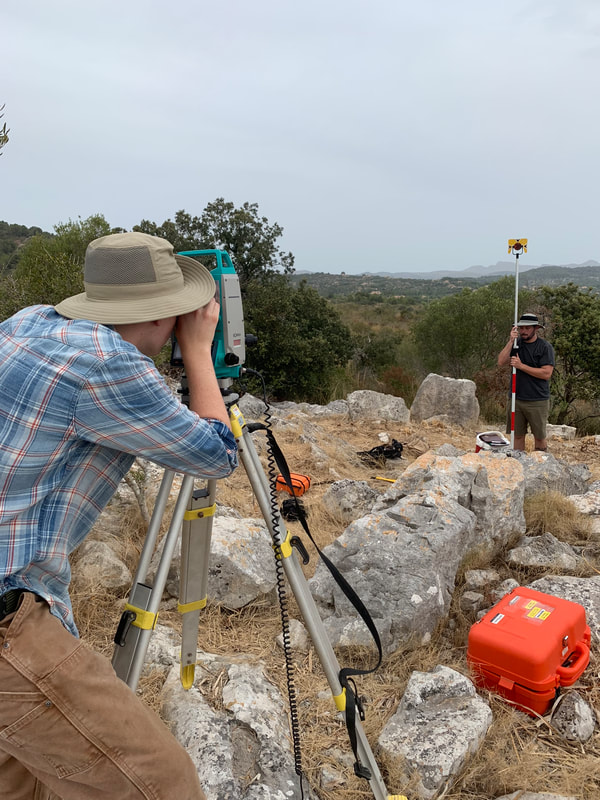 Alex Betz and John Monahan use a total station to record georeferenced points that will be used in creating a 3D model
This year we decided to take a break from the traditional pedestrian survey, instead dedicating time to map and record known, but previously unrecorded sites. We concentrated on two sites: Taula des Moro and Corralassos. The former one is a smaller site, a type known as a stepped platform, while the latter consists of the remains of an Iron Age village complex. For the stepped platform, we were able to generate a georeferenced 3D model by means of a drone. The village was much more challenging as it was not cleared of vegetation. Two team of students used two a combination of DGPS and Total Stations to generate a preliminary georeferenced plan.
